|
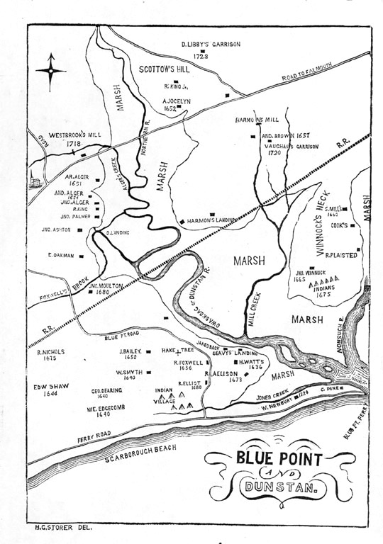
D. Libby's garrison, 1728 R. King Jr A Jocelyn, 1652 Harmon's mill And. Brown, 1657 Vaughan's garrison 1720 Westbrook's mill, 1718 Ar. Alger, 1651 And. Alger, 1654 Jno. Alger R. King Jno. Palmer Jno. Ashton D. landing [Dunstan landing] E. Oakman Jno. Moulton, 1680 Harmon's landing S. Mill's, 1660 Cook's |
R. Plaisted Jno. Winnock, 1665 Indians, 1675 R. Nichols, 1675 Edw. Shaw, 1644 J. Bailey, 1650 W. Smyth, 1740 Geo. Dearing, 1640 Nie. Edgecomb, 1640 Hake tree R. Foxwell, 1636 R. Elliot, 1680 Indian village Janesback Seavy's landing H. Watts, 1636 R. Allison, 1673 W. Newbury, 1720 |
Two other features on the map ar the Scarborough beach and what appears to be a meeting house at the far west on the main highway.
D. Pane-Joyce
Jan 2001. All rights reserved
Located at http://aleph0.clarku.edu/~djoyce/gen/scarborough/BluePoint.html